Mad Mad Madagaskar
Team: Hilde Aass and Rune Gjeldnes.
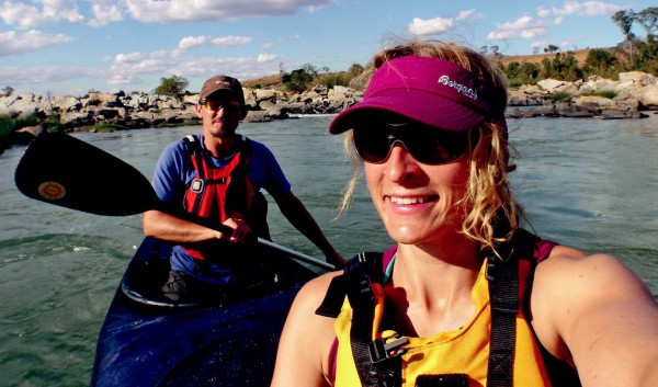
Type: River canoing expedition.
Where: Mangoky River, which has the largest draining basin in Madagascar, consisting of the Mananantanana -, Matsiatra – and the Zomandao River. Mananantanana River will be our river down to Mangoky.
Ambition: To become the first team to canoe down from the upper part of Mananantanana River from a height of 1000 m, down to the main river, Mangoky, and all the way out to the coastline. It is a Pilot project, where Rune want and plan to to at least four of the big islands and the most challenging river on each of them, and to experience the contrasts between them
Distance: Total 680 km.
Slope: 1000 meter.
Duration: 19th of July – 29th of August.
Temp: 5°C to 35°C (It is wintertime on Madagascar this time of the year).
Main dangers: Tropical diseases, Nile crocodiles, waterfalls, scorpions, Dahalos
Equipment: Open list in pdf
LINK TO OLD EXPEDITION PAGE: MADAGASCAR EXPEDITION

Expedition pictures update
During the expedition we have had hard time to charge all the electronics, mainly because we were in a valley and somedays with cloudy weather. It became to much electronic equipment for the solar panel we used, and a hard lesson learn. Next time I will use the same as on all of my polar trips. Big lithium batteries. Another challenge and experience was using the sat.phone in a rivervalley like we had. It was sometimes hard to get signals and too short airtime to transfer a picture.

Foot vs Baobao
Back home
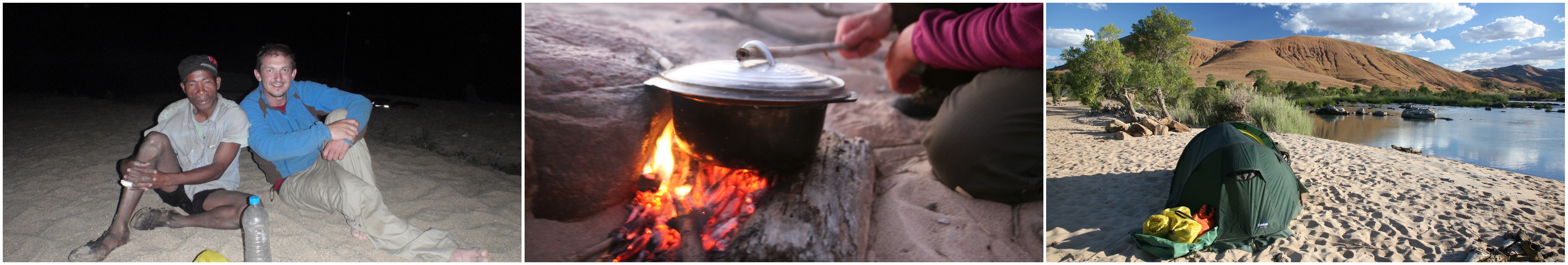
Well back in Norway after six fantastic weeks on Madagascar. The four weeks journey down the river has been even more exciting, more challenging and more beautiful than expected. It will take time to digest all the memories, and they will never be forgotten. One of the best memories is all the friendly and helpful people during the whole travel. Big smiles everywhere! The wildlife and scenery has been breathtaking. We have had really good and exciting white-water canoeing. Times to time impossible river, where we had to carry instead of paddle, but it was part of the expedition, expected, and we enjoyed it. Being first to paddle down Mananantanana was also a great feeling. Already missing the daily life and challenges on Mananantanana and Mangoky River J
22/8
The definitive worst day so far on the expedition! They have spent 23 hours in a very crowded lorry rebuildt to a “bus” traveling from Tanambao to Tulear. The distance is only 200 Km and a travel time of 23 hours covering that distance gives a good indication on the quality of the roads. Terrible! It was extremely crowded with a too many people, chickens, ducks. Rune said it was so cramped that he couldn’t even manage to get his coat of, because it was stuck between his back and the knees of the guy sitting behind him! Anyway, tonight they found a nice hotel and decent meal and are looking forward to a nice relaxing day on the beach tomorrow. Well deserved!
21/8, Success!
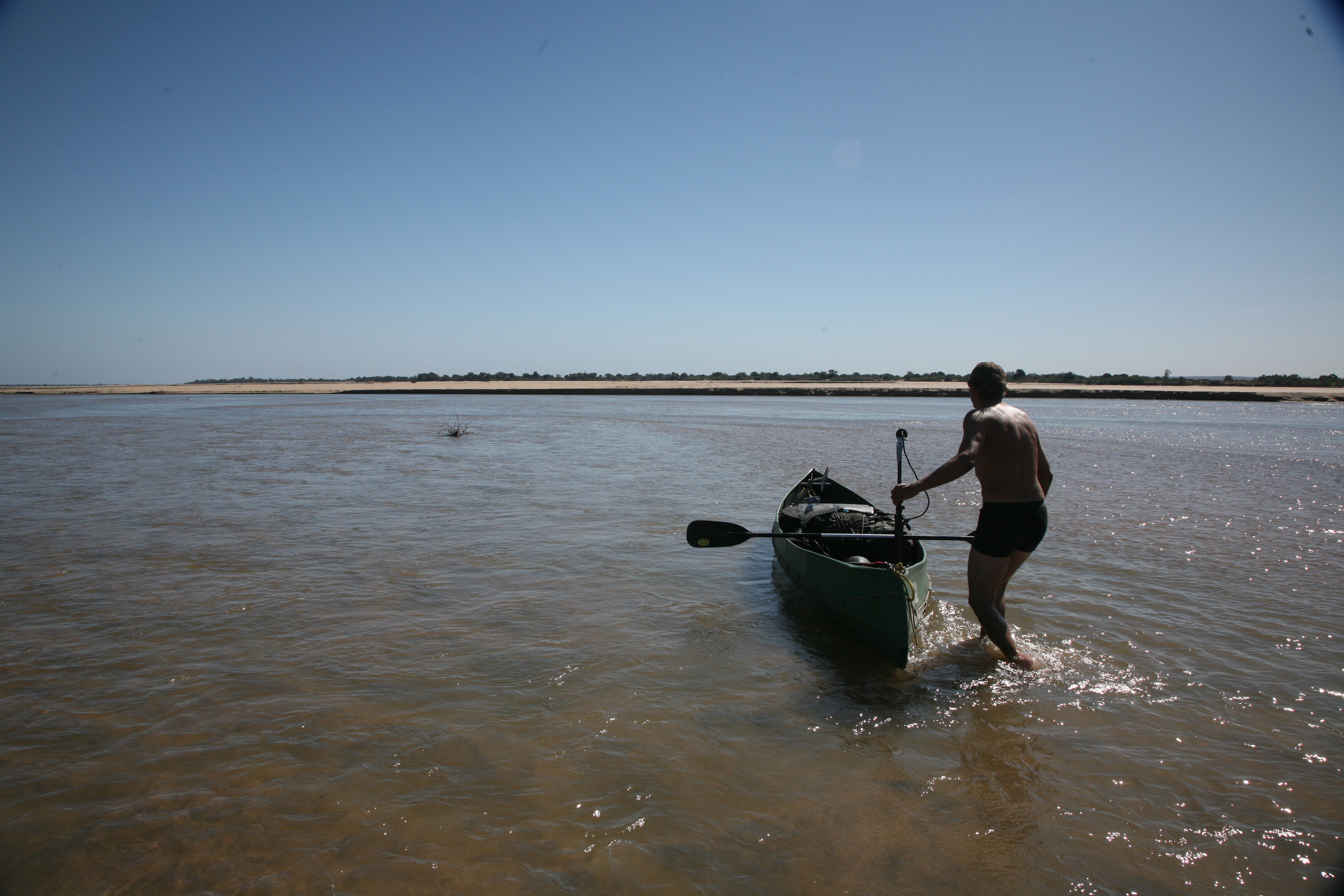
Last day on Mangoky delta. Hard to find enough water.
Success! The team was expected to reach Ambiky after a few hours of canoeing on Saturday, but decided to continue to Tanambao after consulting the locals. They reached the final destination, Tanambao, Saturday noon local time after 27 days on the river. Congratulations! .
20/8
Pos 21.50.25 S 54.07.10 E (Map is updated!)
Still making good progress. The river is doing a nice 3-4 km/h so they are now drifting down the river and able to watch the wild life in more detail. Today they have seen a chameleon, lots of lemurs and more of the giant bats. They are on schedule and expect to finish the expedition in Ambiky tomorrow night.

19/8
pos 21.50.08 S 44.25.48 E (Map is updated!)
Another good day on the river. They are in fact making so good progress that they expect to reach Ambiky, the final destination, on Saturday evening.
18/8
Pos 21.43.06 S 44.53.52 E (Map is updated!)
Hilde and Rune are making good progress. It is their 3rd day on Mangoky and the river is wider with less rapids, just as expected. Again they have seen local people and villages. They stopped in one of the villages today and traded some resupplies, fresh tomatoes, onions and rice, which made a nice addition to the freeze-dried food they have brought for dinner. We had hoped that the team would be able to use the solar panels more once they reached Mangoky, but this has unfortunately not happened. They are spending a lot of time charging, but it is a slow process. The last few days they have not even managed to charge the iridium phones, but the weather improved a little today, so the iridium is now back online.
15/8Pos 21.25.48 S 45.33.45 E (Map is updated!)
Hard to be a Ally!
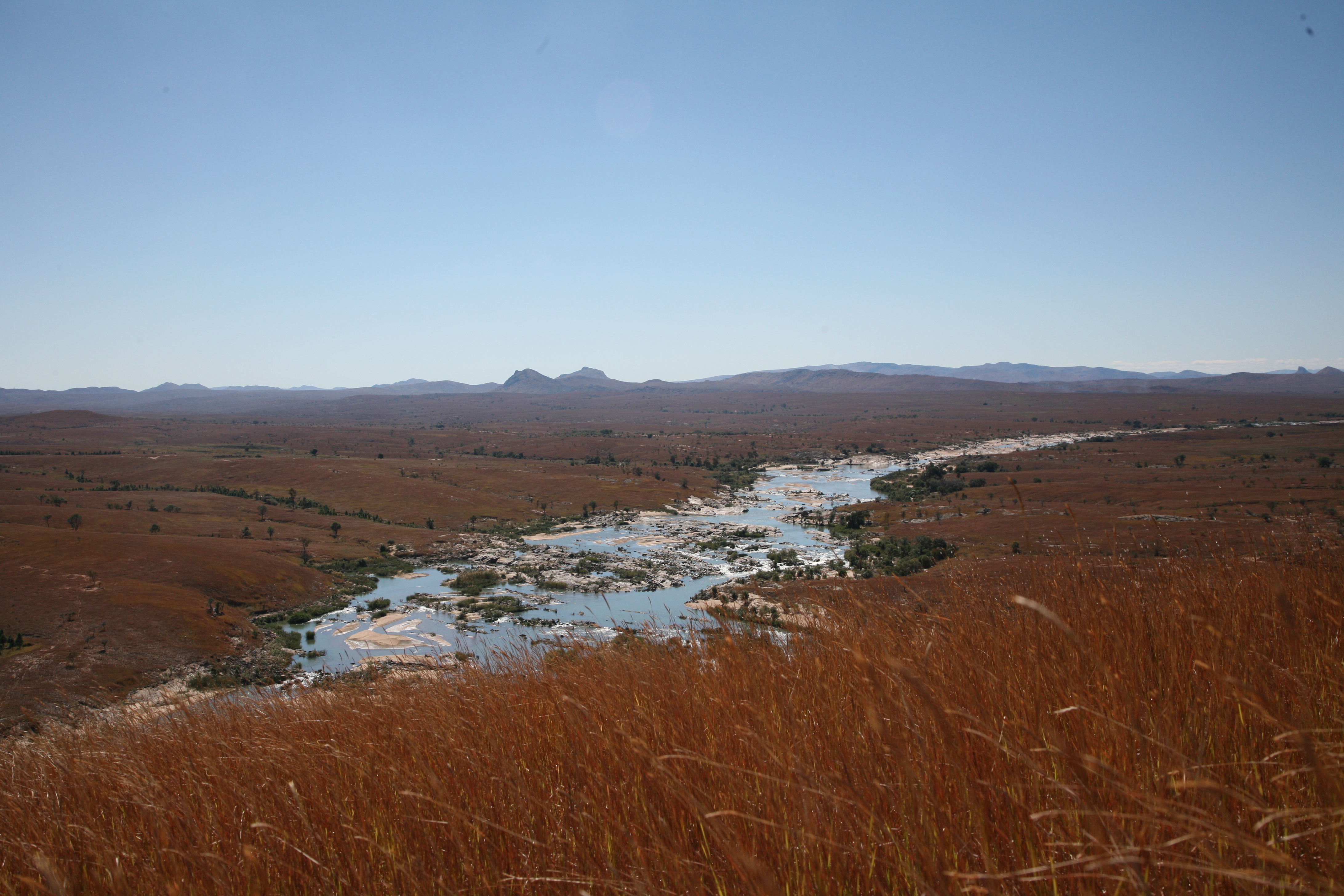
Another hard day on the river with lots of waterfalls, rapids and a giant water roll that almost broke the canoe in two made them capsize. The good news is that they managed to capture it on film with an on-shore camera! Another piece of good news is that they are out of the valley and have reached the Matsiatra junction, which is where the part of the river called Mangoky starts. This part of the river is wider with a lot more water and less rapids and waterfalls. They have again found a nice campsite on a small beach approximately 206 meters above sea level. They are thrilled to have reached Matsiatra and to have conquered the most extreme part of the river. They expect much better canoeing conditions ahead, and there are several small settlements and villages ahead where they can meet locals and perhaps do some trading. They will hopefully also be able to use the solar panels to charge the batteries in the next few days, so that we again can get some live pictures from the expedition. (You can follow the expedition in Google Earth by opening this file: http://sites.google.com/site/runegjeldnesproject/55km.kmz)
14/8
Pos:21.24.56 S 45.34.56 E (Map is updated!)
They found a nice campsite today, a small beach between to waterfalls. It has been another extreme day on the river, but still they managed to do an acceptable distance. They still have trouble with charging, so they spend a couple of hours this morning charging, but it was only enough to charge the video batteries for the filming. Hopefully they will finish the most extreme part of the river by tomorrow. The team had an unusual sight today; they saw about a 100 giants bats hanging in a tree. The bats are one of the largest species in the world with a wingspan of 60-80 centimeters and very rare sight.
13/8
Pos: 21.23.56 S 45.36.19 E (Map is updated!)
The team made a good distance today, even though the area has not improved much, with regards to the canoeing. The valley is still very narrow, and white-water is only occasionally replaced by shallow, rocky water. The canoe has taken a lot of beating, even though they have carried the equipment passed several of the worst areas. The good news is that they have descended made more than 200 meters in altitude the last four days and they are now ‘only’290 meters above sea level. They have issues with charging the batteries because of lack of sunshine due to the steep mountain sides and overcast weather. Hopefully this will improve soon, so the team again is able to transmit pictures from the expedition.

12/8
Pos:21 25′ 18″ s – 45 37′ 23″ E (Map is updated!)
– 330 m Down the river. Not much paddling, but some. Rest has been carrying and ferrying. Stones, rocks and drops we can’t take. Also has to be carefull with the canoe which has got really hard treatment. had to do a quite big repearing today. Rocky terrain, slow but steady movement down the slopes. We are low on batteries, no good charg ing when it has been overcast last few days + we are in a deep wally with bad sat.com. Hilde won tonight’s competition: 4 shotingstars + 2 satellites. Rune 1shotings. + 1sat. New good day tomorrow.
11/8
Pos: 21 26’06″S 45 39’03″E (Map is updated!)
An challenging and exciting day. Just done 3 km, but we are proud of it. Rocky and stony terrain and river. Had to carry all the gear four times, done some ferrying…once ended almost in catastrophe when the canoe capsized and was pushed against a big stone. Lucky to save everything. Have done some good rapids, but not everything with controll. Two we did backwards half of it 😉 and we have done our biggest drop ever on this trip. Two meter…a bit higher than we thougt, and the canoe had a hard time. Same with Rune’s knee which hit a nice stone. We where welcomed by 9 Ringtails LEMURS when we came to todays camp. Great day and looking forward for new day tomorrow. Excitement high and Mood good.
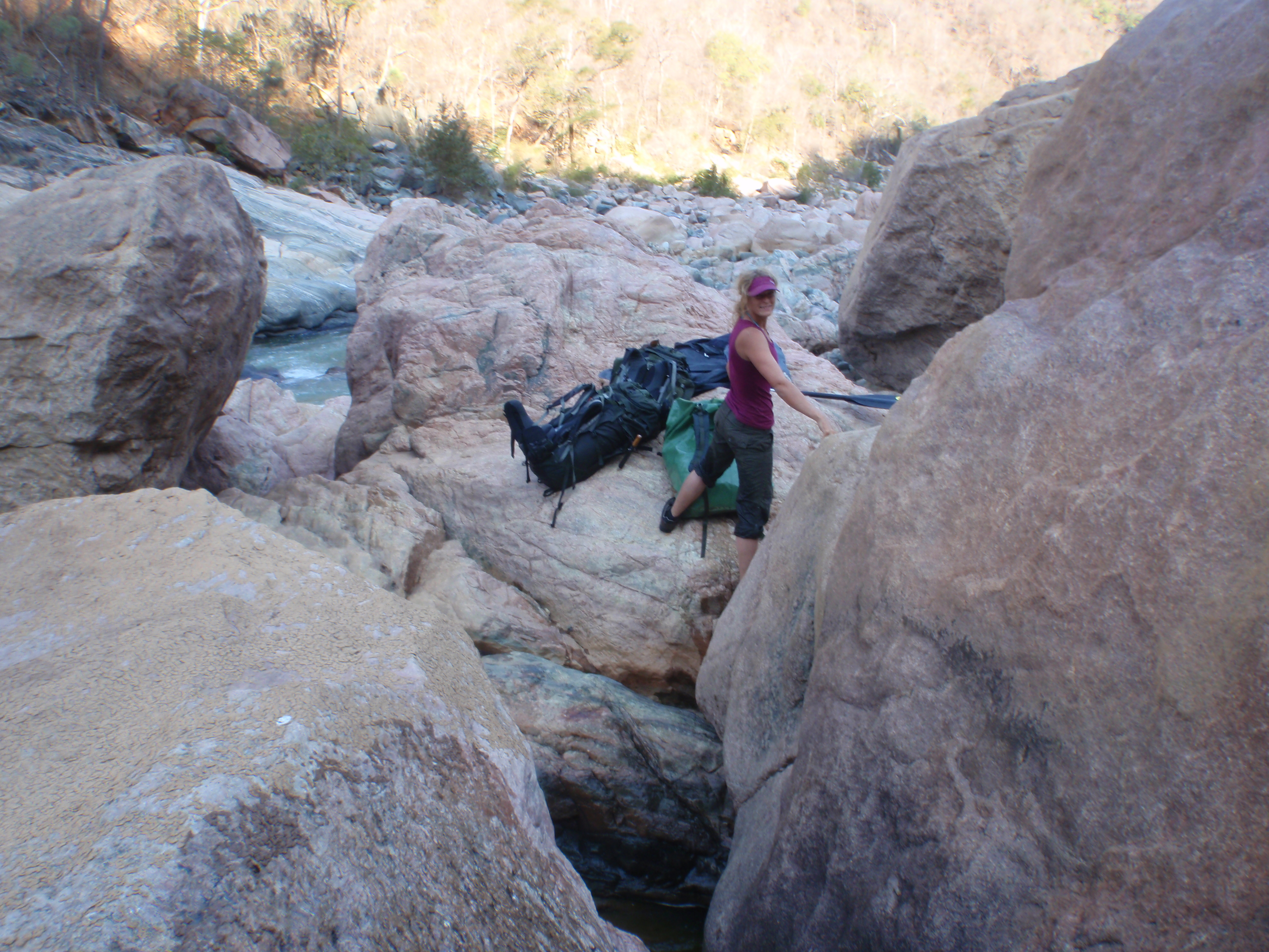
Climbing down the river with all the gear and canoe.
10/8
Pos: 21.25.12S 45.40.24E (Map is updated!)
No report an picture today. Temporarily unable to charge PDA. To see todays position, click “Map” on menu above.
9/8 Charging challenges!
Pos:21.25.43s 45.41.09 E (Map is updated!)
No report an picture today. Temporarily unable to charge PDA. To see todays position, click “Map” on menu above.
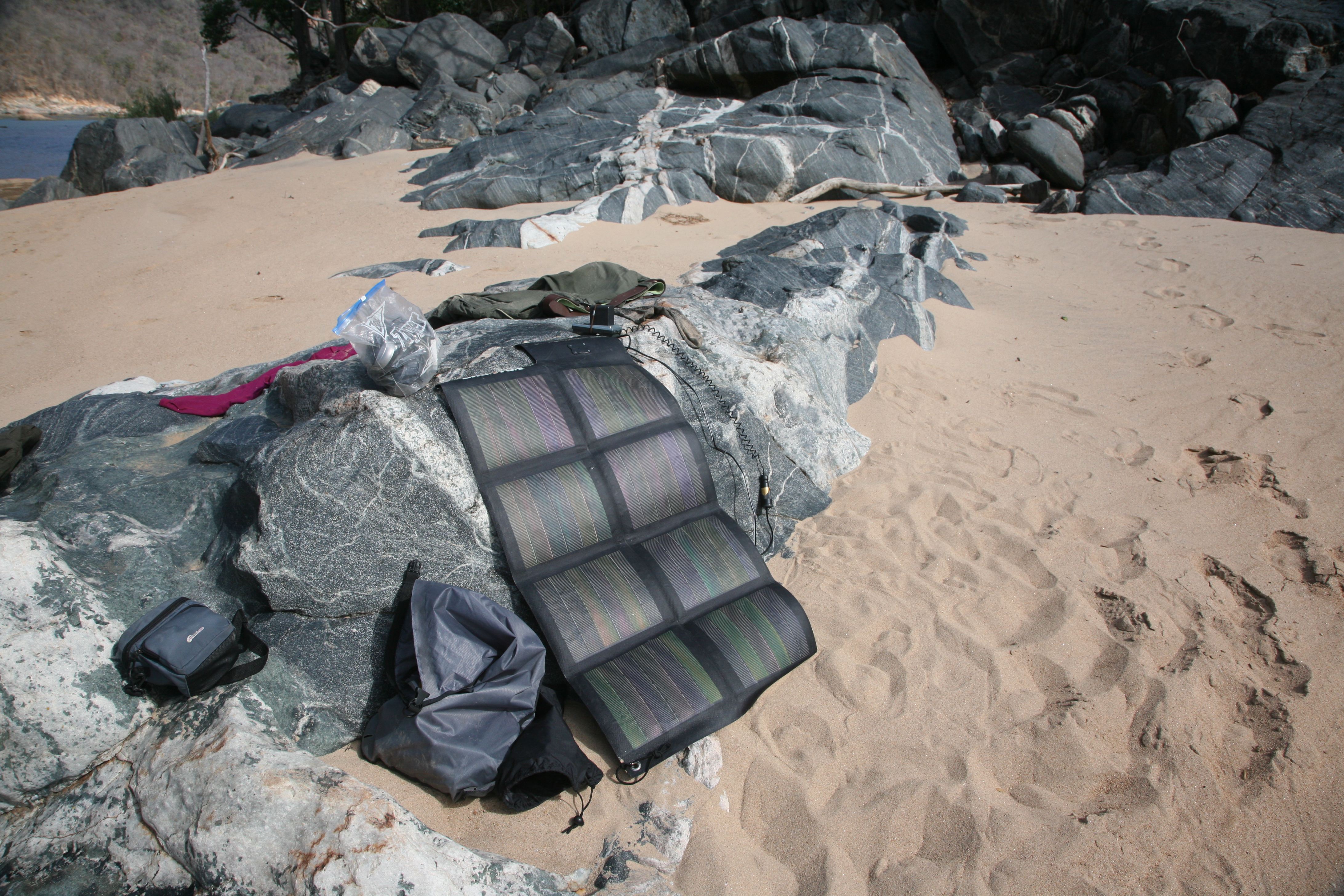
Solarpanels trouble
8/8
Pos:21 27′ 16″ S – 045 42′ 50″ E (Map is updated!)
Long day on and at the river. Lot’s of rapids, and many of them too hard for us. 4 is too much and would have crushed both canoe and us. Ferrying the canoe down several times and three times carrying everything down. We are now camping in between big rocks (NB!Pic from yesterday camp!), and ready to carry everything down to the next possible spot to padle. Approximately 800 m to carry, but we know it will be a good day. It is going down, and we think this will be the practice next days. Lot’s of Eagels to watche today, even very closely. 8-10 at one time. Nice day. Nice evening, nice food and extreme landscape. Hoolaa shaakeer!
7/8 Close Call!
Pos:21 26′ 14 S- 045 45′ 33″E (Map is updated!)

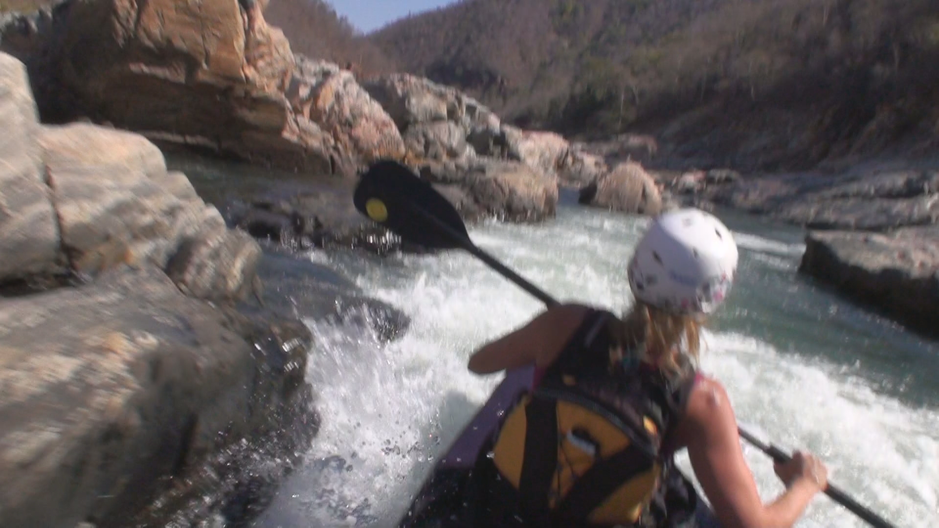
Almost too much White Water for us and the Ally.
Whow! Close call in one of several nice but big rapids today. We where almost taken down on the left and I was almost saying goodbye to two cameraes. I was out of balance, but luckily Hilde had some balance left, and pushed hard right and saved the whole situation. Teamwork! We are in the wally now and the scenery is really breathtaking! Hard to send pic’s from this area! Did a mountain this Morning to get some overview. Nice up in the high also. Lot’s of wildlife and now we are on oure own. Everything perfect, and excited for the next day of adventure.(No new picture today)
6/8
Pos:21 26′ 11″S – 045 48′ 55″E (Map is updated!)
New day is at is end. Used much time today to charge batteries. And we had a pretty rough padling for some kilometres. It’s going down and there are rapids which will crush the canoe. We have to move around this parts. Crashed into some rocks again, and have to do some repearing tomorrow morning. Big rift in the front. Easy to fix. Lets rumble.(No new picture today)
5/8
Pos: 21 25′ 35″ S 045 50′ 34″ E (Map is updated!)
Started the day with some good waves and rapids. We thougt we should go into the wally…but that one lasted just for one and half kilometres. Rest of the day have been more open landscape than ever 🙂 Anyway, there has been some decendings which has been good and bad. Again hard to be canoe and two bad holes in contact with rocks.. Total weight now should be 240 kg at least. Biggest crock so fare. Est. 3 m spiceman, and it gave respect, and a bit more carefull taking a bath now. Has been a good day, and tomorrow will be a good one too!
4/8
End of the Plateau.
Pos: 21.20.04 S 045.53.50 E (Map is updated!)
Day have become evening and it is full Moon on the Platau. Last day up here. We camped on the edge, and start on the rapids tomorrow morning. Beautiful place, just a bit noisy because of the whithwater beside and below. 400 m decending next 4-5 days which is A LOT for us. Time will show.Today have been easy going, with some challenges to find the way down the river. Not much water when it is wide and slow going. Had few rapids and banged hard into some stones, and had to do some repearing on the canoe. Now it is going into a not so wide wally? Remote is the word. We are in very good spirit and lot off fun. Looking forward to some good whithwater canoing. THIS IS LIFE! (No picture today)
3/8
Pos: 21.17.40 S 46.04.50 E (Map is updated!)
Clear blue sky, no wind and a big bright burning sun. Luckely we have been close to water 🙂 The river has grown in size (the wrong way) and we got stuck on shallow water several times. Found a good solution to the problem. Me standing up in the canoe pointing out the direction while Friday (..eh.. I mean Rune) paddling. Had dinner guest tonight. Served tomatoe soup with “potetmos” and he brought some sugar cane we chewed on for desert. The sun has set and the wind is picking up. And as we look to the west we see a whole mountain side on fire…
2/8
Pos:21 16’10” S – 046 11’18″E (Map is updated!)
this has been a day with wildlife more than earlier days. Saw five new types of birds we hav not seen so fare, and it has been lively, except very few locals. 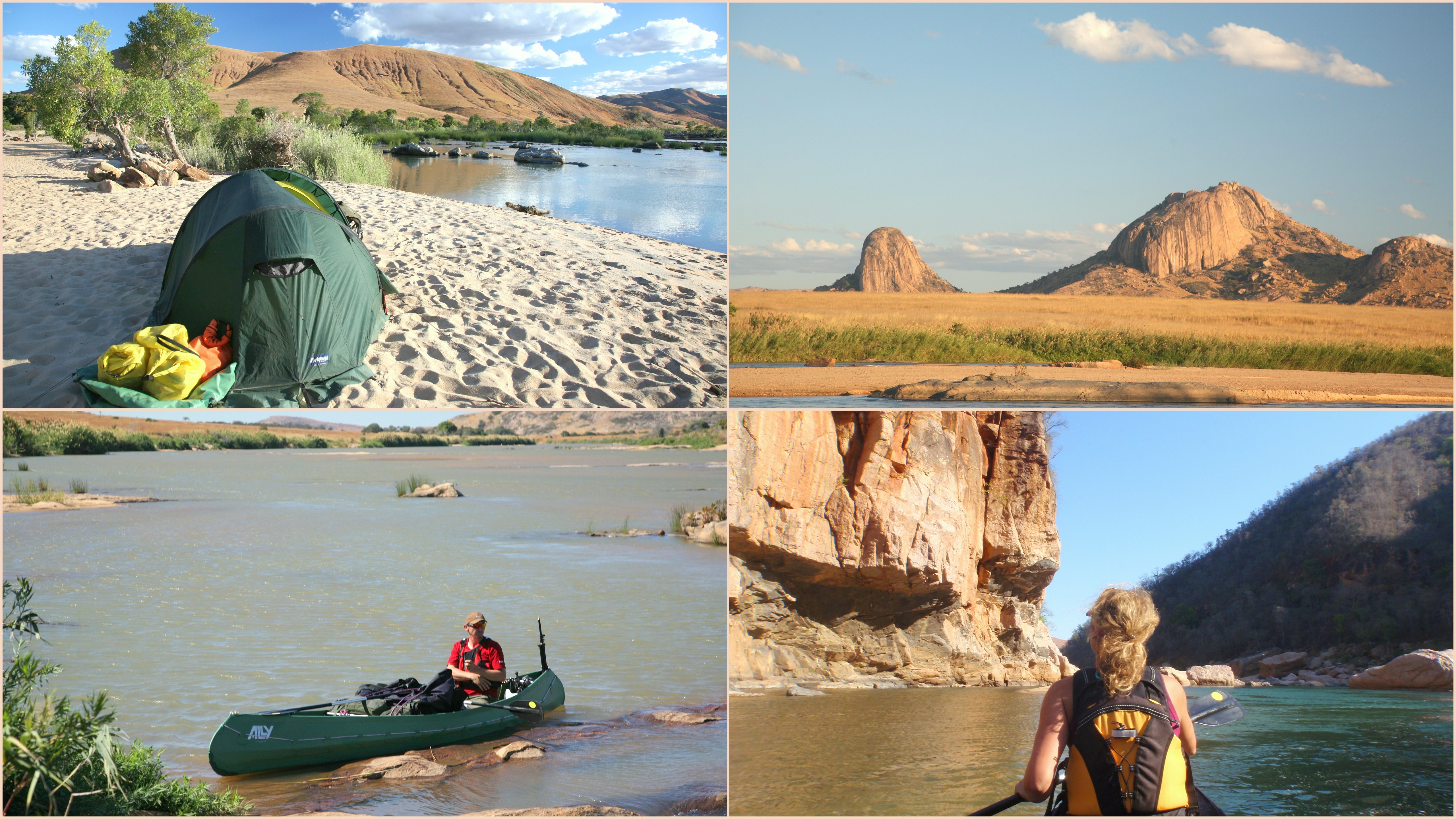 We are now out on Plaine de Tsitondroina and it’s a wide and remote (what we can see) area. Endless landscape with grass, some hills and wallys, and some mountains. Really special. Has been blowing 12-18 knots most of the day, last night and tonight. Strange?! And sunny sunny day. A new Crock’s record today. Four spices about just 2 m. Big enough, yet. Been out in the terrain twice to get an overview and an other perspective of where and how we travel.
1/8
Pos:21 17′ 50″ S – 046 20′ 39″E (Map is updated!)
Day 6 on the river. best whitewater so fare on the expedition. We should not have done it, but we could not resist. Everything was wild and white, and everything was under “control” untill we lost controll totally when chrashing into three big rocks and was jammed there for seconds and the story could have been different. But, something or someone made the canoe, turne 360 degrees, and we got “controll” again down the rest of the slope. Big smiles and high five, and even got it on tape. Several good rapids and then it became very easy going and very scenic mountains. Are in a quite remote area at the moment. Not much people to see. Also went up on a big hill, to get the fantastic view. Not so long day or distances, sun is burning, but a good day. Happy wedding Did&Trine 🙂
31/7
Pos:21 23′ 17″ S – 046 26′ 36″ E (Map is updated!)
Fifth day on the rive, and it has been really wide some places with hundreds and hundreds of small islands. Difficult to choose the right slope down when you can’t see what’s in front. most of the time we managed to keep the “main-stream” and when lost, lots off pushing and pulling. Almost capsized twice:-) Descended 60 m today and that’s good. Hectic day, but this afternoon we have taken a bath, what we where not told to do, tried fishing without luck (I always bring too big fishinghooks) Charging batteries, cleaning wather etc. New day tomorrow . Hooolaa shaaker.
30/7
Pos:21 28′ 23″ S – 46 33′ 48″E (Map is updated!)
slow going day with some few small rapids and lot of drifting. Enjoyed the day! Sun has been burning, but I, Rune,have been using the fleece. Have had a kind of a flu for five days, and feel sorry for Hilde who has taken the hardest work out, big time. Have a nice camp tonight and have had big audience on the other side river.
29/7
Pos: 21 33′ 01”S 46 38′ 81”E (Map is updated!)
The river is getting bigger. Today the first “blumps” followed by elegant dark tails slipping into the water. Suddenly logs on the river have gotten a new kind of attention. People along the river seems scared when we pass. First running and hiding in the long grass, then slowly sticking out their heads and after a couple of friendly greatings from us, they’re running along the river side smiling and shouting Good progress again. A nice campsite and sunshine dried up last days wet clothes and gear.
28/7
Pos:21 42′ 24″ S – 46 40′ 32″ E (Map is updated!)
Woke up this morning with a gassic family right outside the tent opening. Salam!
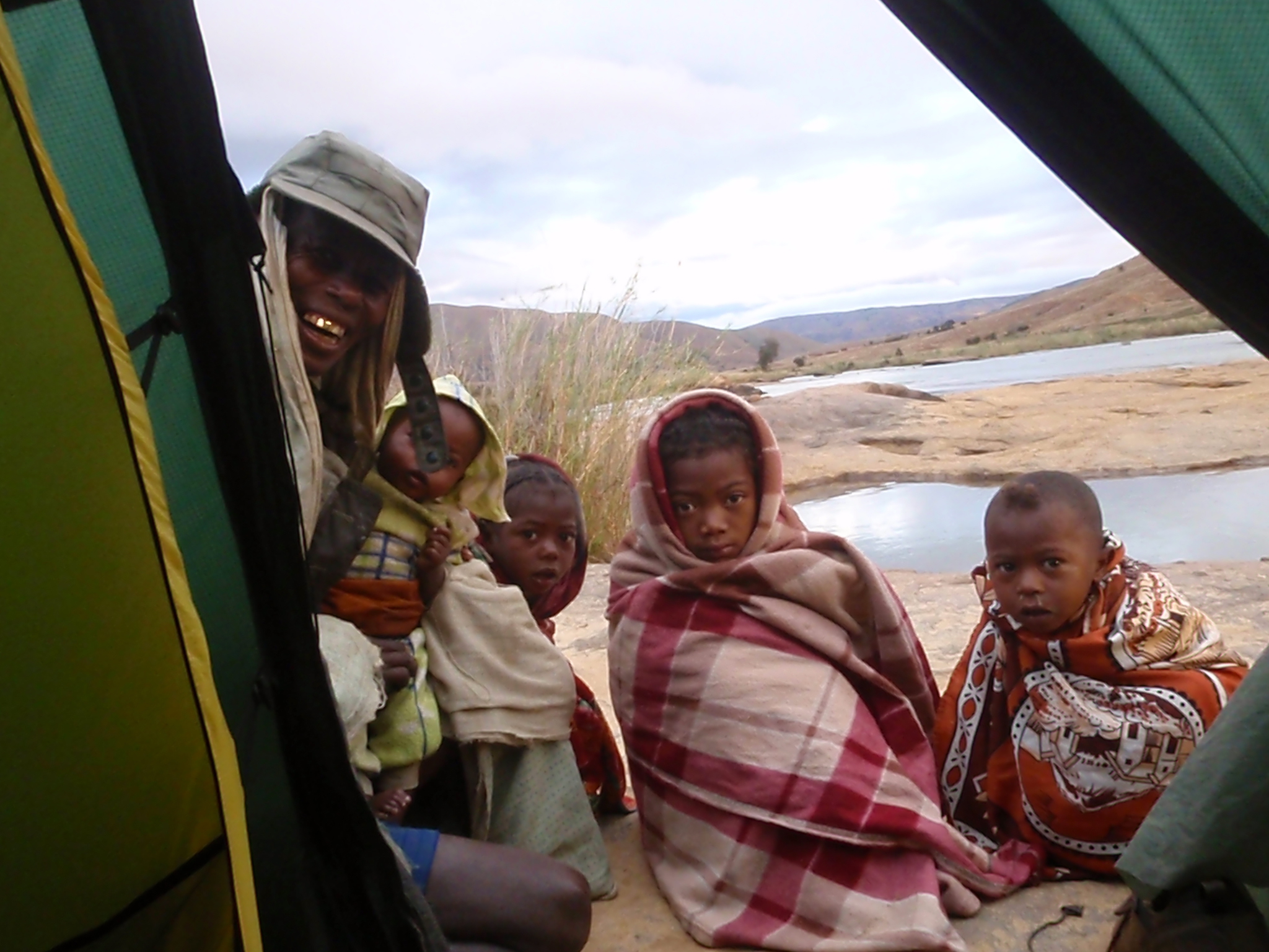
Family visit in the morning.
Hilde tested out some of her gassic glosary and picked up a few new words. What a day! Done 30-40 rapids and descended a lot of meters and done better distance than expected. Has been a rough day for the Ally (the canoe) and us, hitting stones and rocks all the time in the rapids. Much in and out of the canoe, pull and push, and jump into the canoe again, and hope for the best. Lot of fun situations and good paddling. Has been heavy raining all day and tunderstorm tonight, thought we were in Africa 🙂
25/7
New day is over. Not really as planned for Rune, when sick. Hopefully better tomorrow. Oh yeah! Hilde has been up on a peak and went through some forest on the way; snakes, skulls and graves. Real culture experieence, as the anchestores are seen as the true owners of the island. We may start tomorrow if Rune is well again..
24/7
Hi all! Finally at last camp before the start. Andringitra N. Park, and will stay here untill Sunday, just to get known to the Madagascar nature.
 The area is insane! Huge mountain- walls over the place, red earth and ready to do the last prep. We are two days delayed because of late arrival and engine down on our first car. that’s why we may stay another night at this plase. Hilde certainly want to climb, and there are great possibilityies. Time will show. Lot to do and prepare. Sorry no pictures updates yet. Will come. Some starting challenges We have got very good help from Madamax expedition, and Max. Max and Hilde is just having a Malagasy language lesson. Anyway, we have already experienced A LOT and lot of fun! And soon ready to rumbel the Mananantananan River. Will be great! SOAVA ALINA!
Madagascar expedition on schedule!
19th of July we will depart for Madagascar for six weeks. Mangoky River and Mananantanana River (upper part of Mangoky) will be our playground for 640 km. But first we will visit the Capital, Antananarivo. We will need some time to get the cargo (canoe and other gear) through the custom and shopping provision for the entire trip. Then do the last preparation and packing before the 12 hours drive down to Ambalavo and further to Andringitra National Park, where the expedition starts.
Link VG(Canoeing in Sjoa River): VG article
Canoe training on Oppdal and Sjoa

First weekend in July, we had some really good canoeing in Oppdal- and Sjoa River. Heavy white water and good fun. 100 % sure that everything went wrong, but ended up laughing “down-stairs” the canyon, have done something we thought was no possible.Well equipped, but forgot a spray-skirt, and had problem taking in too much water. Sjoa had huge amount of water, because of hot weather for weeks and heavy snow melting in the mountain. We had to take the easy part. Clever! That was enough. Used the spare time to do some modification on the canoe and get control on the equipment. We sent the cargo the 10th and hopfully we will see it the 20th of July in Tana:)
Medical training
Both of us have several medic courses, but it’s always important to do a brush up before each expedition. We had one evening with Dr. Kjell, specialist in anesthetic and he will be the expedition doctor.
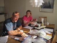
Dr. Kjell teaching and brushing us up on medic.
All the medicine was gone through, and the most possible and common injuries and treats for this type of expedition. Madagascar has tropical climate, and one of the biggest treats is definitely tropical diseases, like malaria, dengue fever, bilharzias, typhoid fever etc. Scorpions and wasps can be annoying. The most important for us will be to take precautions. Cover up bare skin especially in the dusk and nighttime. Further, insect repellant and never drink water without using the water cleaning system.
